The Digitizing Process
In order to realize such a performance, Geoplan 3D has divided the Hydroparken into four parts:
- 3D scans all the building surfaces, the outdoor spaces, and every indoor space as well.
- Create valid building information models from the 3D scan and store them on the open BIM format, IFC.
- Generate correct floor plans for all the floors of all the buildings.
- Establish a geolocated set of points on the property to correctly locate the model data on the earth.
The work was then divided into four phases with a precise schedule:
- 10 days of scanning followed by 6 weeks of modeling (generating models from the scanned data).
- 5 days of scanning followed by 5 weeks of modeling.
- 5 days of scanning followed by 5 weeks of modeling.
- Additional scanning as needed followed by 3-4 weeks of fine-tuning of the models
The project found advantages in dividing the work into phases like this so that learning along the way could be applied to both scanning and modeling to improve efficiency and quality.
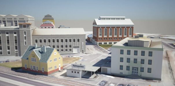
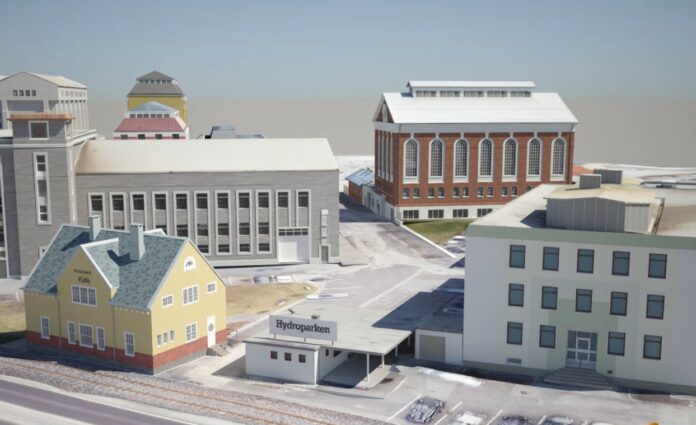
The facade of some buildings in the Hydroparken project
Smooth Digital Collaboration
When capturing a world heritage park into a digital twin, very little is automatic and smooth sailing. Old valuable buildings have their own esthetics and building practice embedded in their look and feel. Capturing this in modern digital tools requires the experts to adapt and learn along the way. The iterative process set up by Geoplan 3D together with the clear visual communication allowed by Catenda Hub (previously Bimsync), made it possible to optimize for success.
“With Catenda Hub (previously Bimsync), it was efficient to apply our thorough quality assurance processes, to make sure the models at the end were of high quality and with the data needed by the owner of the Hydropark. I believe the use of the Catenda Hub (previously Bimsync) saved us a significant amount of time that would otherwise be considered wasted due to poor communication and less efficient quality assurance,” said Håkon Ramstad, engineer at Geoplan 3D.
I believe the use of the Catenda Hub saved us a significant amount of time that would otherwise be considered wasted due to poor communication and less efficient quality assurance.
Håkon Ramstad, Engineer at Geoplan 3D.
Geoplan 3D put a lot of effort into making sure the resulting models actually reflect the reality of the scanned data. Sometimes this required strong modeling skills and a deep understanding of the buildings scanned. Geoplan 3D involved several of their own experts in various fields to make sure the results are of high quality. This meant that clear communication between several experts across different disciplines was important.
“Being part of ensuring a sustainable usage of an asset on the world heritage list of UNESCO, together with such a high-quality minded team as Geoplan 3D, is something that we are very proud of. Based on the thousands of projects out there that have used our platform to improve communication and saved countless hours, we did expect Geoplan 3D to show similar results,” says Håvard Brekke Bell, CEO of Catenda.
About Geoplan 3D
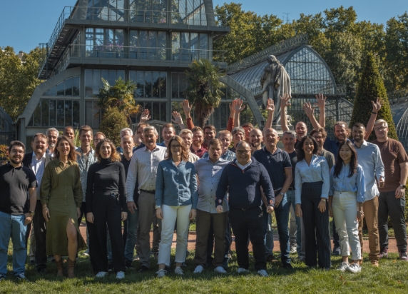
Geoplan 3D is one of Norway’s leading companies in the fields of surveying services, 3D laser scanning, BIM-modeling, quantity calculation, and machine control. Geoplan 3D has over 20 years’ experience with surveying and was the first company in Norway to adopt 3D laser scanning technology. Geoplan 3D strives to be an active partner throughout all active projects and have therefore focused on being the best provider of digital solutions in addition to their traditional services.